Would you like to live in a rugged city?
Getting your Trinity Audio player ready... |
Traditional urban planning has favored “concentric” layouts with a central core surrounded by suburbs and arable land. But one researcher proposes that cities should be planned to be “rough”. What does this model consist of and what benefits can it bring to a city’s environment and even its food security?
For two centuries the guiding theory of urban development has held that cities need a dense central core, with low-density suburbs and circulating arable land around that center. This urban design is known as concentric.
But recently Catherine Brinkley, a veterinarian and professor of Human Ecology at UC Davis in the United States, published research in which she argues that cities should function more like coral reefs: supported by a diversity of niches, of small centralities.
Simply put, this means that cities should mix green and environmentally productive zones with urbanized sectors in a “decentralized” scheme. In ecology and medical science, the term for a physical form with such topographic complexity is “roughness”.
The roughness theory of urban growth has antecedents in some of the more modern theories of spatial ecology and landscape ecology. The morphology of the city in relation to its surrounding ecosystems has been studied since the late 1980s.
These studies of urban morphology and spatial ecology explain how organisms have evolved physical and behavioral characteristics to exploit the environmental texture of their landscape, just as many of the natural resources have shaped the growth and form of the city. It is here that the concept of roughness can be useful in guiding urban growth to take better advantage of local ecosystem services.
Brinkley thus challenges that status quo of concentric planning in his article “High roughness cities: the geographic, economic, and regulatory pathology of America’s most non-concentric urban areas.” The text was published a few weeks ago in the scientific journal Land Use Policy.
Hand-shaped cities, not concentric circles
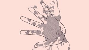
“Greater roughness can be achieved by maximizing urban connectedness through the implementation of green belts, green zones and wildlife habitat corridors,” Brinkley explains in her article.
The researcher cites examples such as Portland (USA), Copenhagen (Denmark) and to some extent, San Francisco (USA). “Even though San Francisco is a very compact city, it has Golden Gate Park in the middle and thus breaks up the urban space with green spaces,” she explained.
In his study, Brinkley looked at 483 urban areas in the United States that also had farmland and green space surrounding them. Several of the places studied are dominated by large national or state parks, lakes and river corridors.
The one common characteristic among the top 30 high roughness counties she identified-with dissimilar state or local planning government structures-is that they had equal pressure to both develop housing and have abundant productive farmland.
In addition, many of the counties with the highest roughness urban connections are in major agricultural producing areas of the United States.
The concept of hand-shaped cities is not new. Perhaps the major reference is the Five Finger Plan, developed in 1947 in Copenhagen, through the Urban Planning Laboratory in collaboration with several urban planners. This urban development plan focuses on both metropolitan rail lines and green spaces in between.
A city where what is grown reaches the citizen faster
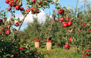
Brinkley links her concept of the rugged city with another issue that is an ongoing subject of study for her and some of her colleagues: food deserts.
Food deserts are described as those geographic areas in which their inhabitants have little or no availability of healthy foods (especially fresh fruits and vegetables), due to the absence of grocery stores within convenient travel distance.
To better understand this phenomenon, it is sufficient to cite a report to Congress by the U.S. Department of Agriculture’s Economic Research Service, which estimates that about 2.3 million people (2.2 percent of all U.S. households) live more than one mile (1.6 km) from a supermarket and do not own their own car.
The public transportation available to urban dwellers can help alleviate the difficulties imposed by distance, but in recent years it has become more complex as economic forces have pushed grocery stores out of many cities, making them so scarce and so far apart that many people are forced to take several buses or trains to do their shopping.
“Having farms and cropland closer to cities generates more profit per acre because you have greater opportunities to sell directly to neighbors at marketing centers,” Brinkley explained.
Brinkley also sees his research as an extension of the concept of “mixed-use” development from the neighborhood to a regional scale. There is also evidence of how interlocking urban and farmland could help lessen the urban heat island effect and improve stormwater runoff management. A heat island refers to a metropolitan area that is significantly warmer than surrounding rural areas due to human activities and lack of vegetation.
In short, this rough city quality helps to reduce the effects of global warming by reducing the heat island effect, generating biodiversity corridors, promoting urban agriculture, the production and consumption of local products, and reducing food transportation times thanks to easy access to urban markets, which also reduces environmental pollution. This model is well worth being observed by Latin American cities and has certain similarities with the biocorridors and sweet spaces plan of the Curridabat canton in Costa Rica, which has already been recognized by several international urban planning entities such as UN Habitat, as an inspiring model for the New Urban Agenda, which promotes the connection between urban and rural areas.


